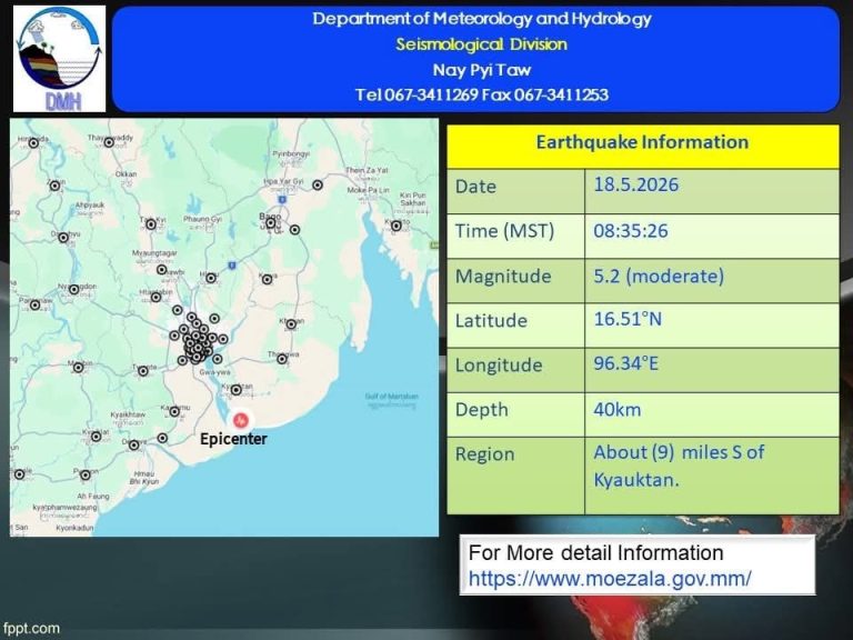
MT News
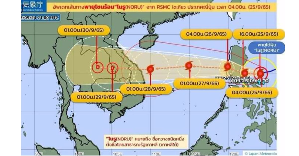
The Department of Meteorology and Hydrology issued a weather warning on 27 September stating that as Super Typhoon Noru is forecast to bring torrential rain, wind gusts, large waves, landfall, and floods over most of Myanmar, people should take full precautions.
According to the observation at 1.30 pm MST today, Typhoon Noru over South China Sea is centered at about 190 nautical miles east of Danang in Vietnam. It is continue to move westwards and may cross into the middle Vietnam coast near Danang on the morning of 28 September, and it is forecast to downgrade as a Tropical Strom. Typhoon Noru is likely to move westwards and gradually weaken as a Land Depression.
Due to the Typhoon Noru, rain or thundershowers will be fairly widespread to widespread in Nay Pyi Taw, Magway, Bago, Yangon, Ayeyawady and Taninthayi regions and Shan, Rakhin, Kayah, Kayin and Mon states with likelihood regionally and isolated heavyfalls with strong wind during two days from September 28 to October 2.
Moreover, squall with rough seas are likely at times Deltaic, Gulf of Mottama, off and along Mon- Taninthayi coasts. Surface wind speed may reach 35 mph. Wave high will be about 8 to 10 feet in Deltaic, Gulf of Mottama, off and along Mon-Taninthayi coasts.
Thus, the Department of Meteorology and Hydrology has warned that people should be aware of the heavy rainfall with strong wind, the natural disasters such as flash flood and landslide in the hilly areas and near small rivers, and inland water transport and domestic flight should be on high alert.